Chapter 3(Preview)
Over the next 50 years, will be driven mainly by human-caused greenhouse gas emissions. Emissions trap heat and water vapour in the atmosphere, leading to warmer temperatures, rising seas and more extreme weather.

Even if emissions slow, the Earth will keep warming because of the gases already in the air. The result? Bigger storms, larger and more frequent floods, hotter summers and shifting coastlines.
The Dyfi Estuary and are likely to face compounding climate-related pressures, including:
- rising sea levels
- higher extreme sea levels during storms
- more intense winter (and possibly summer) rainfall, and runoff
- more frequent and severe river floods
- warmer, drier summers
These will reshape the Estuary and the area’s rivers, the supply and loss of sediment, habitats (, dunes, bog), river dynamics and flood risk to people.
But there is a lot that flood and managers, policymakers and practitioners can do to help people living and working in the Dyfi Estuary and adapt to these changes – see chapter 9 to learn more.
Predicted , estuary and river changes
Sea level rises and higher storm levels
UK projections show significant increases in mean sea level (gradual increase in the average height of the sea surface) and extreme sea levels (events where the highest water levels occur) when storm surges and tides coincide.
According to the UK Climate Projections (UKCP18), sea levels are expected to rise significantly by 2075.
These increases will make it much more likely that low barriers and dunes are breached. The estimated mean sea level rise expected for Ceredigion is 0.8 to 1.07 metres according to Welsh Government predictions.
More intense winter rainfall and higher river flows
Observations and model projections show increases in extreme winter rainfall events, which drive higher river peaks (when the river is at its highest) and faster runoff from the uplands. Which means that river floods are getting more frequent and more severe across the .
River flooding combined with high tides/storm surges create compound flooding events that are more damaging than a standalone event. These will result not only in breaches of Borth beach and Ynyslas Dunes, but also large-scale channel bed and bank , and possible relocation (termed ‘an avulsion’) of the Dyfi River to another part of its floodplain.
In the case of the Western Wales River Basin District that includes the Afon Dyfi , model predictions indicate betweena 30% and 70% increase in river flows by the 2080s (compared to the 1960 to 1991 baseline), according to Welsh Government data.
Warmer seas and altered wave patterns
New research shows that marine heat waves are already becoming an issue. During the heat wave of June 2023, temperatures in the UK’s shallow seas reached 2.9 degrees above the June average for 16 days, according to a study carried out by the University of Exeter, the Met Office and Cefas (Centre for Environment, Fisheries and Science).
These warmer waters near the shore, combined with changing storm tracks (the path that storms follow across a particular region), are altering wave energy and water movement in estuaries.
Ecological changes and prolonged periods of unusually warm ocean temperatures will also affect the diverse groups of organisms living on, in or near the bottom of the sea that influence and sediment .
Changes in the ’s water and land condition
Heavily compacted soil, drained peat bogs and fewer trees because of past farming practices cause water levels to rise more quickly.
Targeted land management can slow and sometimes reduce the flow of water and sediment delivery. Recent natural flood management projects in the Dyfi – such as those in the Afon Pennal and Leri (see chapter 9) – show how important and potentially effective these schemes are.
Unfortunately, in Wales, there is no data available for the long-term effectiveness of these schemes for catchments larger than 10 km2 – and especially during extreme flooding or flooding that lasts weeks to months, according to Welsh Government data.
These schemes do, however, appear to be improving local habitats and biodiversity, but do not prevent flooding during extreme storm events
Spit, dune and beach systems will be under stress
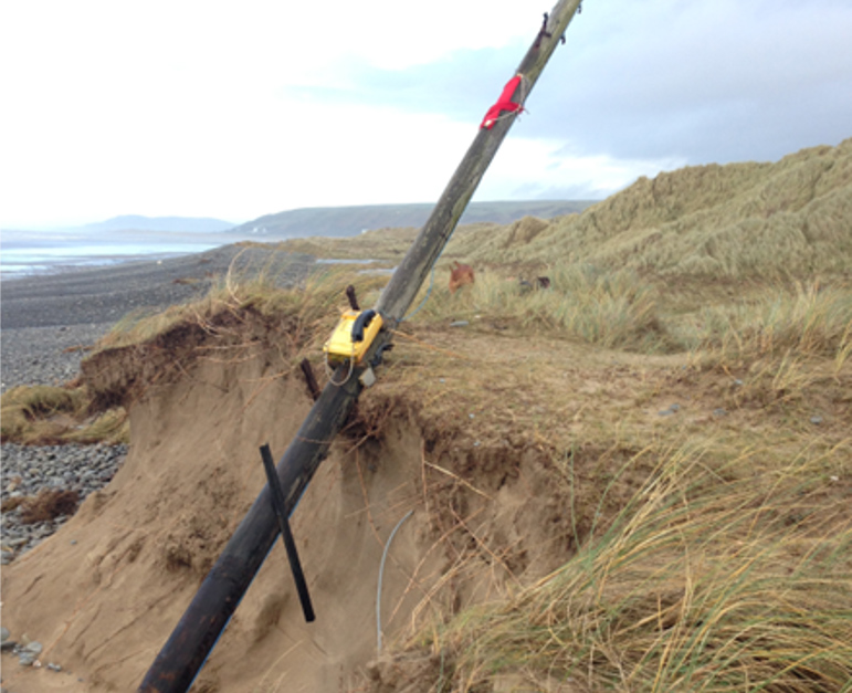
Increased overtopping, pounding waves and higher mean water levels will accelerate dune and cause the Ynyslas-Borth spit to migrate or breach more often
In the case of our valley, the erosion or lowering of spits and dunes leaves the estuary mouth and surrounding lowlandsunprotected against strong waves and saltwater flooding.

Damage to
Saltmarshes naturally act to reduce wave energy and trap fine sediment. Rising water levels combined with fixed sea defences or hard infrastructure that prevent inland migration will reduce a marsh’s size, undermining a key natural defence (a phenomenon termed ‘’, where the water is pushed into specific areas and not allowed to spread out).
If a marsh has space and enough sediment, it can grow. But engineered structures may prevent this from happening.
Damage to floodplains and peatland
More intense winter storms and increased water runoff will cause the low-lying floodplain between Machynlleth and the Dyfi Estuary to flood more often.
Wetter winters may re-wet some peat areas, but warmer, drier summers and further drainage could damage them, weakening the peat’s ability to store water while releasing into the atmosphere.
So, restoring peat is both a resilience and climate mitigation action.
Movement of historical mining waste
During the June 2012 Ceredigion floods, mining waste stored in waste tips and floodplains in the Afon Leri, and Afon Ceulan catchments were eroded and transported downstream. As a result, this contaminated, finegrain sediment was deposited on floodplains and in estuarine environments in lower Dyfi valley.
Increased flooding will remobilise contaminated sediment, damage ecosystems and making it difficult to carry out flood control methods, such as digging ponds in floodplains to store floodwater.
More households, infrastructure and services at risk
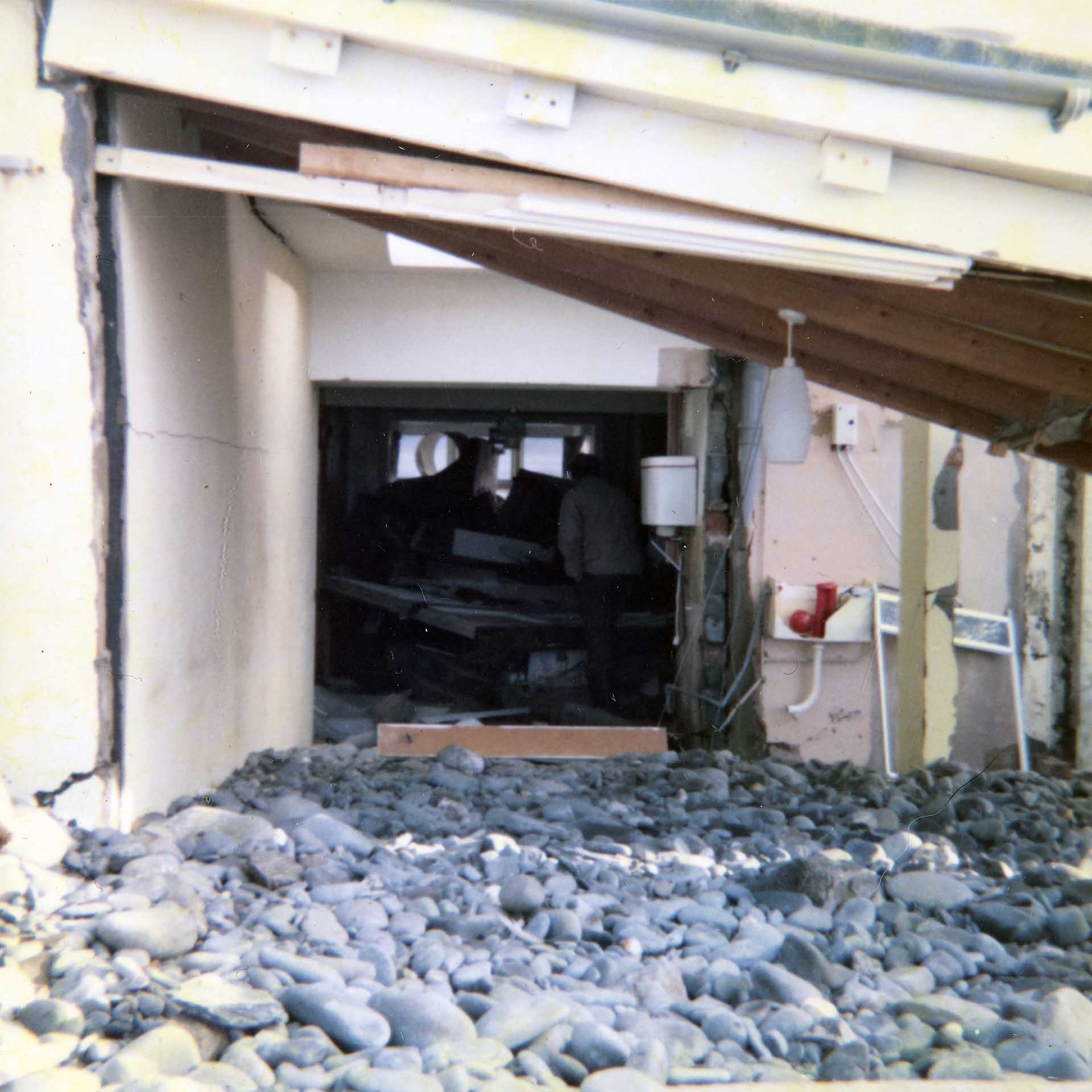
Even with local embankmentsand defences, increased overtopping and backwater flooding will raise the frequency of property-level flooding, leading to higher insurance costs and disruption to roads (like the A487), the railway, utilities and farm livelihoods.
Contaminated floodwater and sewage overflows pose a risk to public health. Knowing the difference between what is right for communities (such as Borth) and what is right for more inland villages such as Talybont will help to properly control flood risks and reduce the severity of flooding.

But the next 50 years offers an opportunity
will not be a single shock to the Dyfi but a process of intersecting pressures – accelerating sea level rise, differing river and responses, contamination from historical mining and changing ecosystems.
What is essential now is to link science and policy tools to longterm, community-led decision making. We also need to adopt adaptive, incremental responses that favour nature-based defences backed by targeted engineered protection. You can read more about this in chapter 6.
The next 50 years offer an opportunity: by looking after our peatlands, making strategic space for the estuary waters, and supporting communities and landowners to adapt, the Dyfi can become a model of thatprotects people, nature and heritage.