Chapter 2(Preview)
The Dyfi Estuary and (the area of land where all the rain and streams eventually flow into the same river), lies on the north Cardigan Bay coast of Mid Wales.
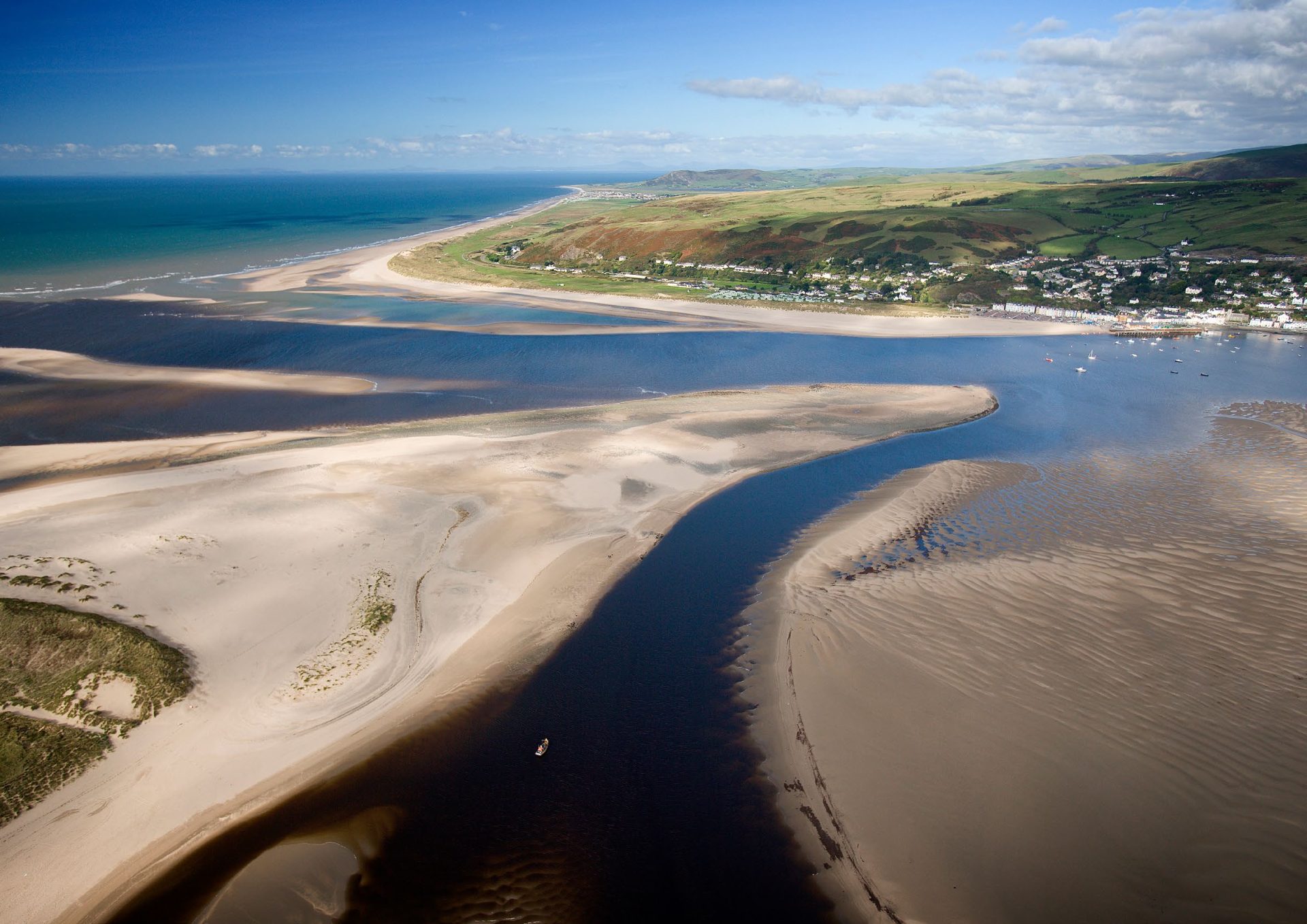
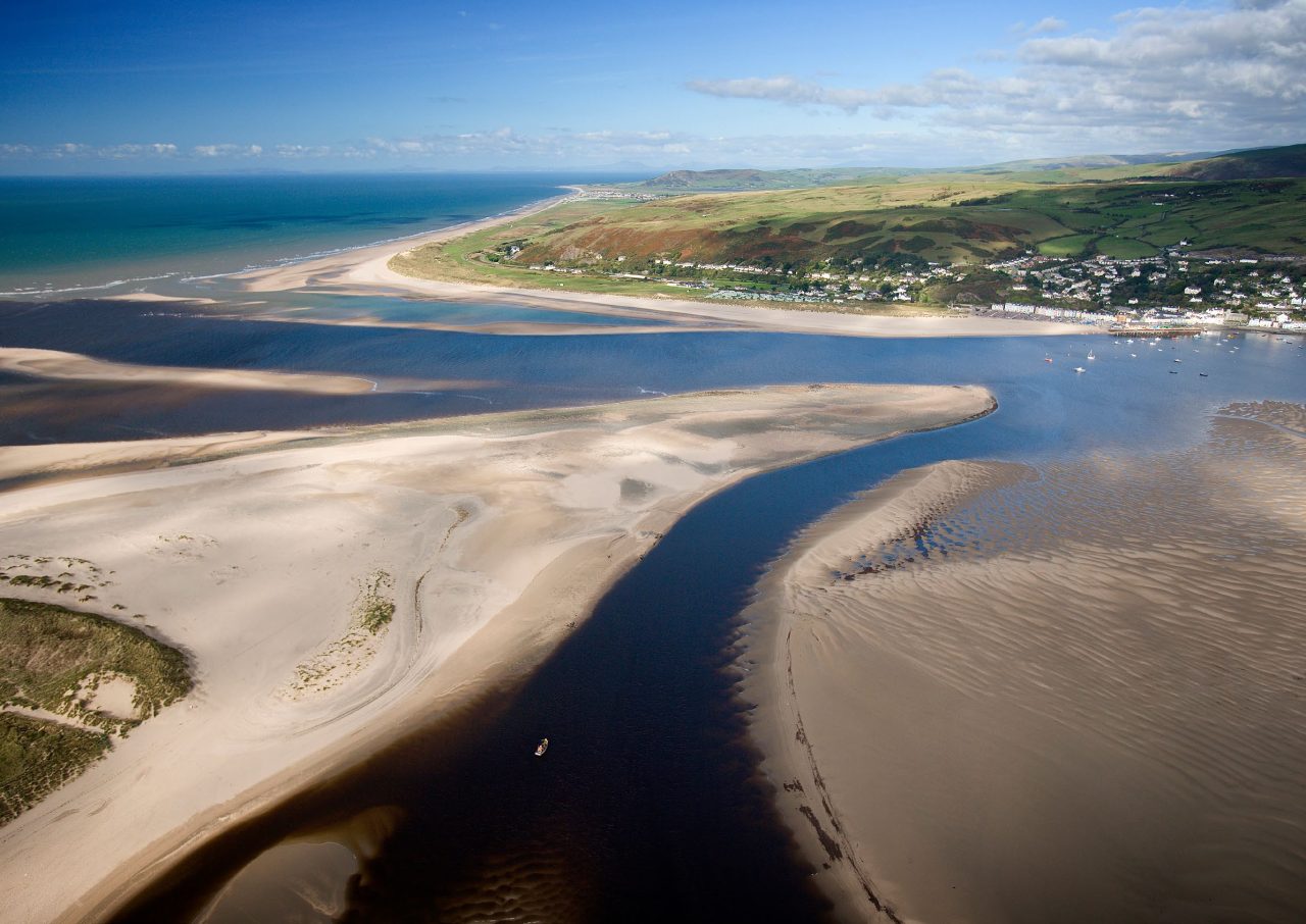
The modern coastline we know and love today – the tidal flats, spits and dunes at Ynyslas, the ribbon of floodplain between Machynlleth and the coast, the low-lying saltmarshes, and Cors Fochno – is the result of dramatic changes that have taken place over the last 11,700 years.
These same long-term processes (sea level changes, peat growth, river and and sedimentation) also created the area’s present-day vulnerability to flooding. They determine which options for reducing the risk of flooding are right for our community, now and in the years to come.
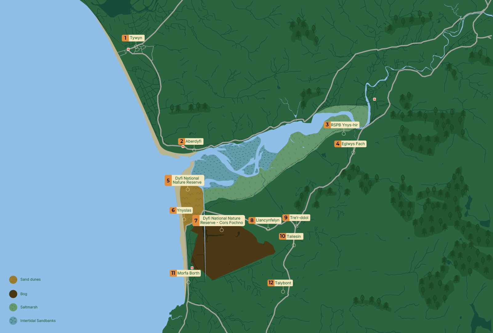
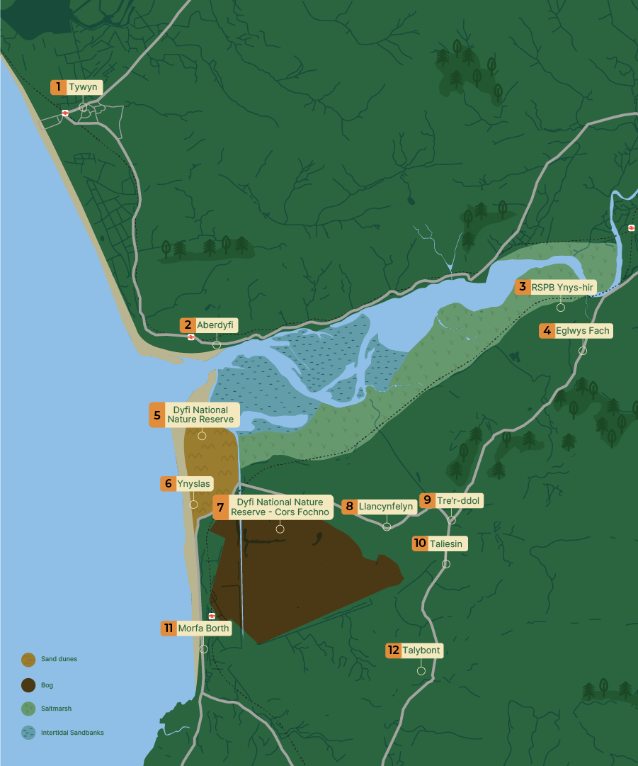
The map shows the Dyfi estuary on the west coast of Wales, opening into the to the west.
The following locations are labelled:
Tywyn (north), Aberdyfi at the estuary mouth, Dyfi National Nature Reserve, Ynyslas, Morfa Borth, Taliesin, Tre’r-ddol, Llandfelyn, Tal-y-bont, Eglwys Fach and RSPB Ynys-hir.
Habitats are colour-coded as follows:
- Twyni tywod (sand dunes) – shown in yellow at Ynyslas, south of the estuary mouth
- Cors (peat bog) – shown in dark brown inland near Morfa Borth
- Morfa heli () – shown in light green along the southern edge of the estuary
- Banciau tywod rhynglanwol ( sandbanks) – shown in blue within the estuary basin
The estuary contains branching tidal channels surrounded by sandbanks.
Back to the start
During the Late epoch, around 27,500 to 23,300 years ago, the landscape of mid-Wales was shaped by two things:
Glaciers that covered most of Wales and the Irish Sea. Meltwater and rising sea level released by glaciers and ice sheets as the climate warmed.
In the Dyfi , thick layers of sand and gravel from and melting ice were deposited on valley floors. They formed a series of raised flat benches (or river terraces) that now sit up to 25 metres above the modern floodplain.
These deposits became the foundation for the rivers to carve out their channels and floodplains.
Ancient river paths preserved on the surface of these terraces show that the Dyfi and neighbouring rivers adjusted their courses repeatedly as , sediment supply and base level fluctuated.
Early-to-mid : Sea levels rise and an estuary forms
As ice sheets and, later, valley retreated from the coast of Wales, the global sea level rose rapidly during the early (11,700 to 8,200 years ago).
The now-submerged offshore Dyfivalley was progressively invaded by the sea. By the mid- (8,200 to 4,200 years ago), it had changed from a river (fluvial) state to an estuary (mixed salt/fresh water). It then transitioned to tidal flats and (or wetlands). The shingle spit at Borth–Ynyslas partially closed the mouth of the estuary and helped create the conditions for the development of Cors Fochno, the raised peat bog immediately inland.
Our modern coastline was broadly established around 6,000 years ago, but growth, spit migration and dune movement remain active.
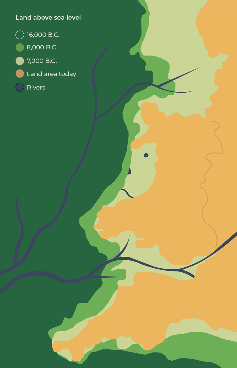
The image is a stylised map illustrating changes in land above sea level over time.
The legend indicates the following:
- Dark green represents land above sea level at 16,000 BC
- Mid green represents land above sea level at 8,000 BC
- Pale green represents land above sea level at 7,000 BC
- Orange represents land area today
- Dark blue lines represent rivers
The map shows that at 16,000 BC the land area was significantly larger, extending further west. By 8,000 BC and 7,000 BC the land mass had reduced in size as sea levels rose. The present-day coastline, shown in orange, represents the smallest extent of land compared with earlier periods.
Multiple rivers are shown flowing across the land, some extending beyond the present-day coastline, indicating river systems that existed before sea levels rose.
The visual demonstrates the gradual reduction of land area over time due to rising sea levels.
Cors Fochno: An archaeological archive
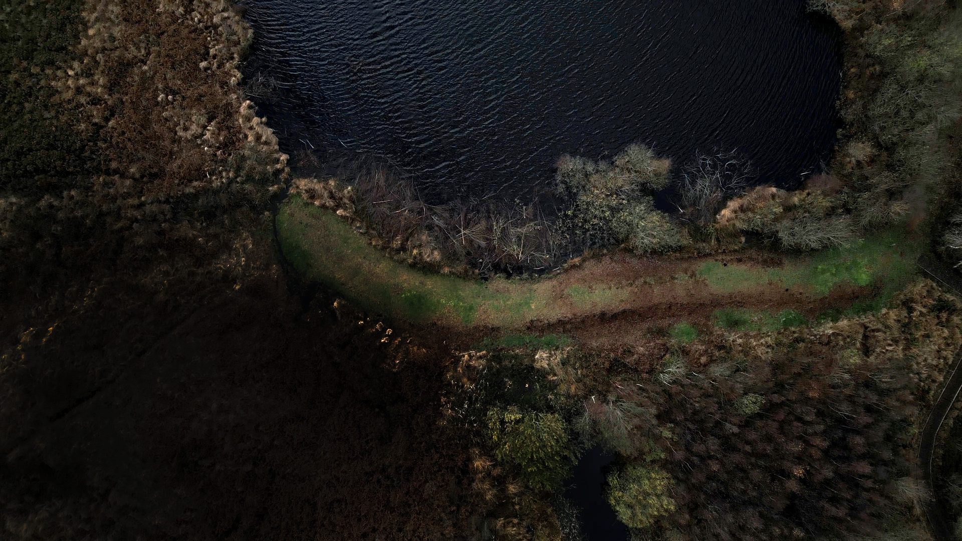
Cors Fochno is a 650-hectare rain-fed peat bog. It is one of the best-preserved in Britain and contains a high-resolution record of the epoch.
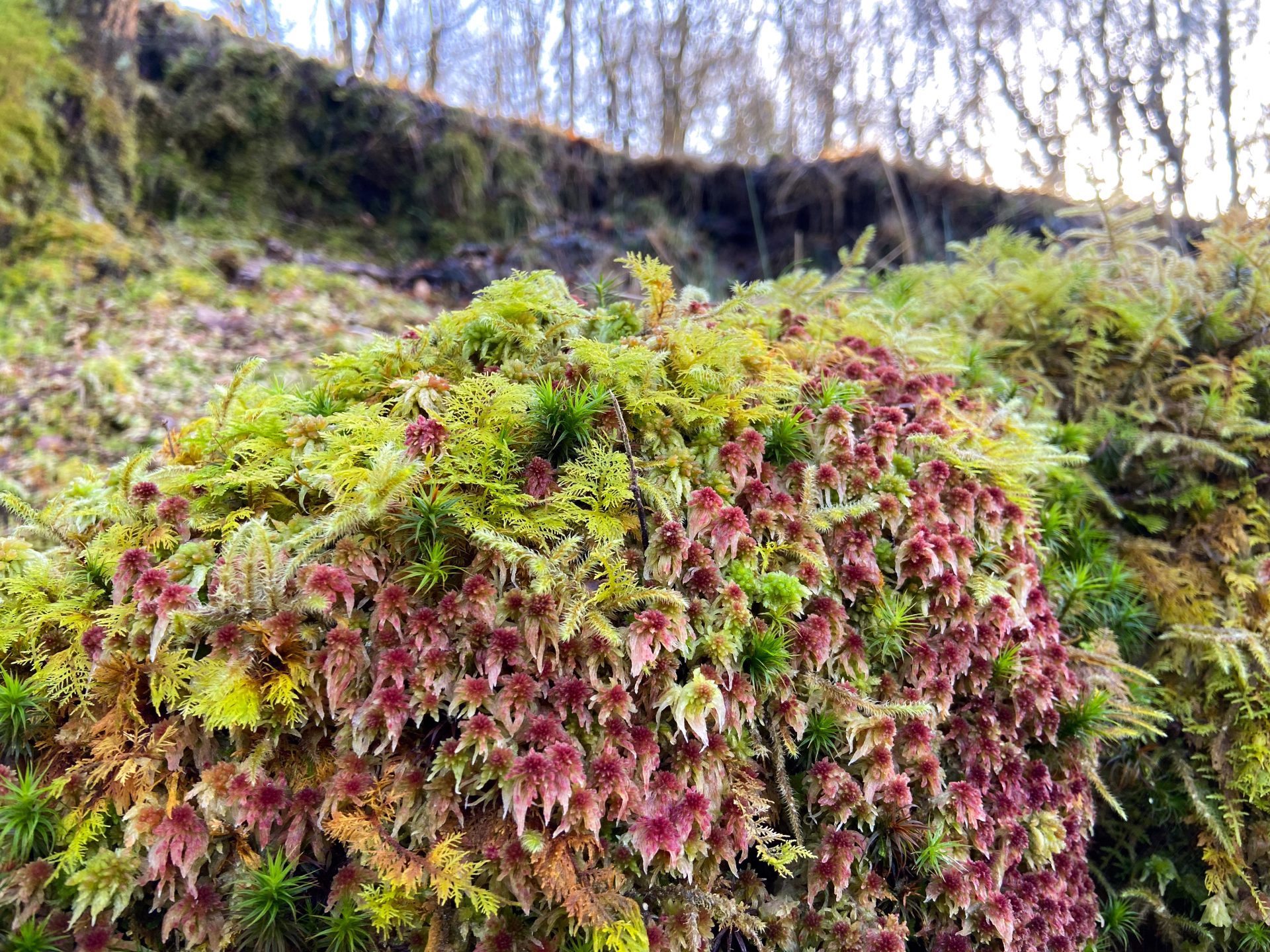
The bog is composed of peat moss, with its central dome reaching a thickness of 5 metres. It started to form on top of an earlier mid forest bed and developed into a rainfed bog about 4,700 to 7,000 years ago.
The layered structure of the bog records past changes in and woodland clearance, as well as when storms took place.
This record has recently been used to track how intense and frequent storms have been in Cardigan Bay over the last 4,500 years.
The bog not only records environmental change, but its peat and drainage system help control local flooding by storing water and reducing the impacts of storm surges.
Cors Fochno also has a rich archaeological record. Key discoveries include a Bronze Age wooden object, evidence of Iron Age/Roman industrial and metal smelting activities, and a medieval trackway
Enclosing a bog and constructing a railway
Cors Fochno
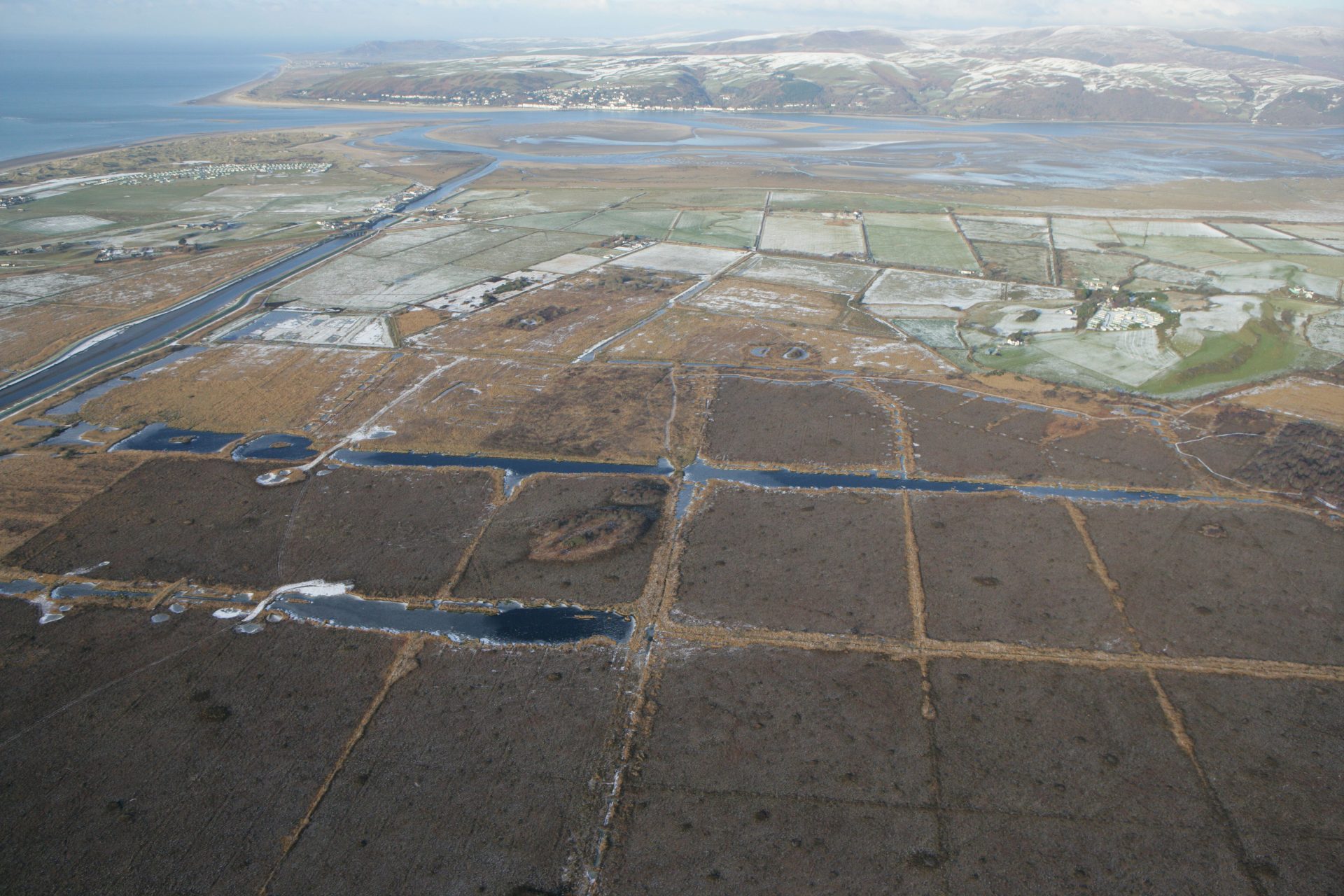
One of the most significant interventions was the enclosure of Cors Fochno between 1813 and 1847. These works also included diverting the Afon Leri directly into the Dyfi Estuary and constructed an embankment along its southern edge.
The embankment reduced the area available to store water below mean high water springs (average highest level that spring tides reach) by 35 percent.
Welsh Coast Railway
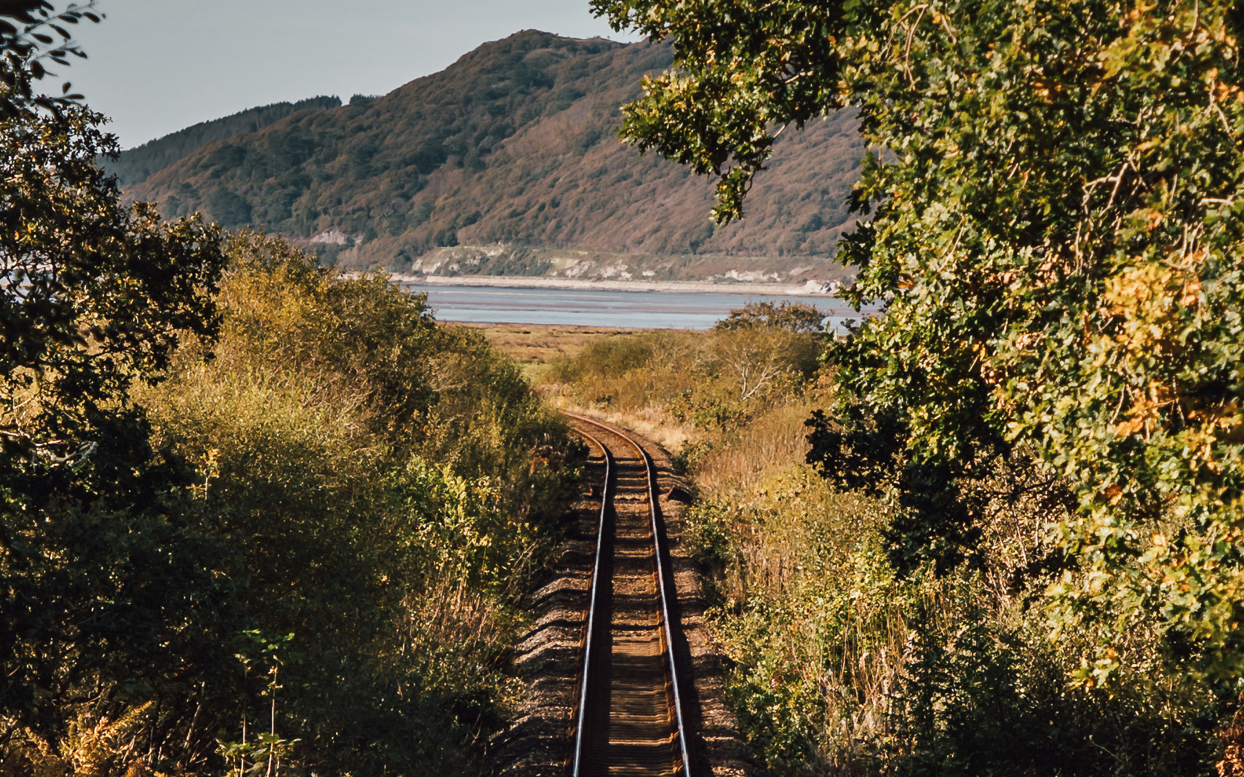
The Welsh Coast Railway, built in the early 1860s, has raised tracks that created a barrier which cut off much of the Dyfi’s floodplain from its main channel – especially within the tidally influenced reach of the river and estuary.
What happened as a result?
These schemes significantly changed the morphology and dynamics of the Dyfi Estuary and lower reaches of the river by:
- reducing water and sediment storage
- preventing sedimentation behind embankments
- delivering more sediment from the Afon Leri, now diverted into the Dyfi Estuary
- funnelling the flood tide further up the estuary.
One of the most obvious results of this intervention is one you can still see today – the land behind the old embankments built between Pennal and Gogarth is 1 metre lower than the land outside them, because it hasn’t had any new layers of sediment deposited on its surface for about 200 years.
The rate the Dyfi Estuary is building up sediment is lower than at any time in the last 1,000 years (see figures 1 and 2). These reflect the increase in woodland, a sharp decrease in farming and, most importantly, the closure of waste-producing metal mines in the , all of which have reduced sediment supply to the estuary.
These changes have greatly improved the area’s biodiversity and ecosystem health. But the reduction in sediment supply could, in the long term, see the lower Dyfi start to erode its own bed. While this may locally reduce flooding, it may also mean that less sediment is delivered to the coast to replenish the beaches, which protects the land from the sea.
Mining for metal
Historical metal mining has had a major impact on sediment supply, sediment quality and sedimentation rates of the Dyfi – particularly in the tidally influenced reach of the Afon Dyfi.
The Dyfi , like much of Mid Wales, contains numerous mineral veins (distinct, sheet-like body of crystallised minerals within rock). These veins, rich in lead, zinc, copper and silver, were worked periodically from Roman times through to the 19th century.
Mining reached its peak during the 18th and 19th centuries, when large volumes of ore were extracted and the resultant waste entered the river network. This resulted in widespread contamination that still continues to pollute the Afon Dyfi and many of its tributaries today – made worse by more frequent and severe flooding.

Keeping contaminants at bay
Historical mining places several constraints on flood and management. Floodplain reworking or engineering projects that change the course of the river may disturb contaminated , risking the release of metals into the environment. And this can harm the Dyfi Estuary’s ecosystem and potentially enter food chains.
Ways to help prevent this include:
- Before any major works take place, an environmental assessment must be conducted to evaluate the contaminant levels.
- Stabilising or cleaning up existing waste material can reduce the flow of heavy metals carried by sediment.
- Natural flood management schemes that increase local vegetation cover and slow runoff can reduce (the highest point of a flood). They can also trap contaminants before they reach main rivers.
Protecting people, property and nature
From the medieval period through to the present day, a variety of measures have been taken to reduce flooding, and to protect people, property and nature in the Dyfi – particularly in Dyfi Estuary and in the tidally influenced reach of the river upstream to Machynlleth.
Embankments and land drainage were constructed on both sides of the river between Pennal and Gogarth to protect land from flooding, and also around the margins of Cors Fochno.
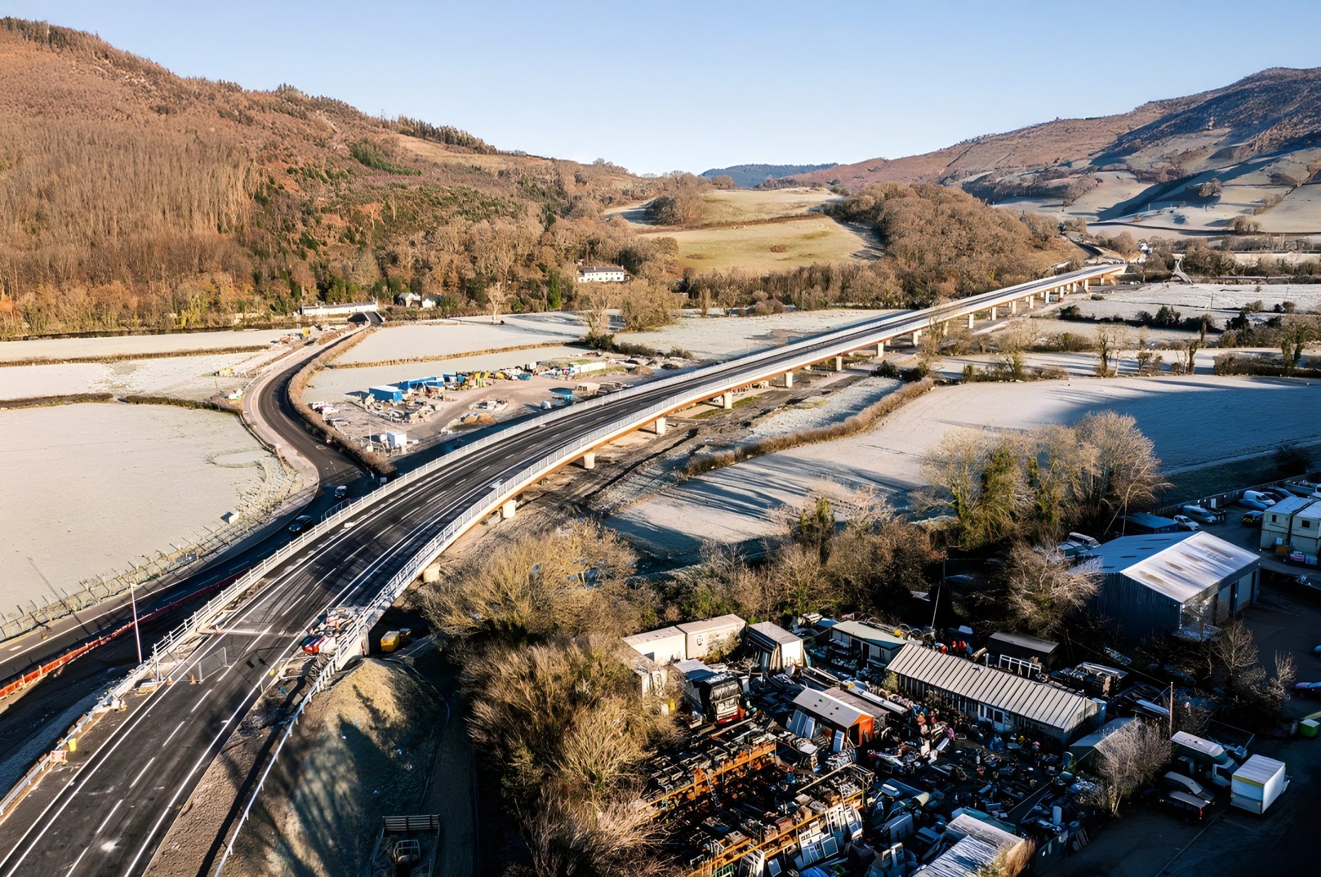
One of the biggest measures has been the new Dyfi Bridge, near Machynlleth. Opened in February 2024, at a cost of £46m, it was built to improve the A487 trunk road and provide a more resilient route, especially during floods.
All of these structures can protect infrastructure locally. But they can also change where water flows during high river flows and storm surges – sometimes concentrating risk downstream or in places with fewer natural buffers.
Recent modelling for the Dyfi emphasises the interaction between engineered measures and natural systems, and the need to plan with space for water.
We’re also now doing more work to preserve key species along the estuary, with recognition of the important nature reserves including Pen Llŷn a’r Sarnau Special Area of Conservation (PLAS SAC), Dyfi Biosphere and the Dyfi National Nature Reserve.
In the future, we will have to decide how we manage land for nature, knowing that with there will be winners and losers among the species living within the estuary.